


Description
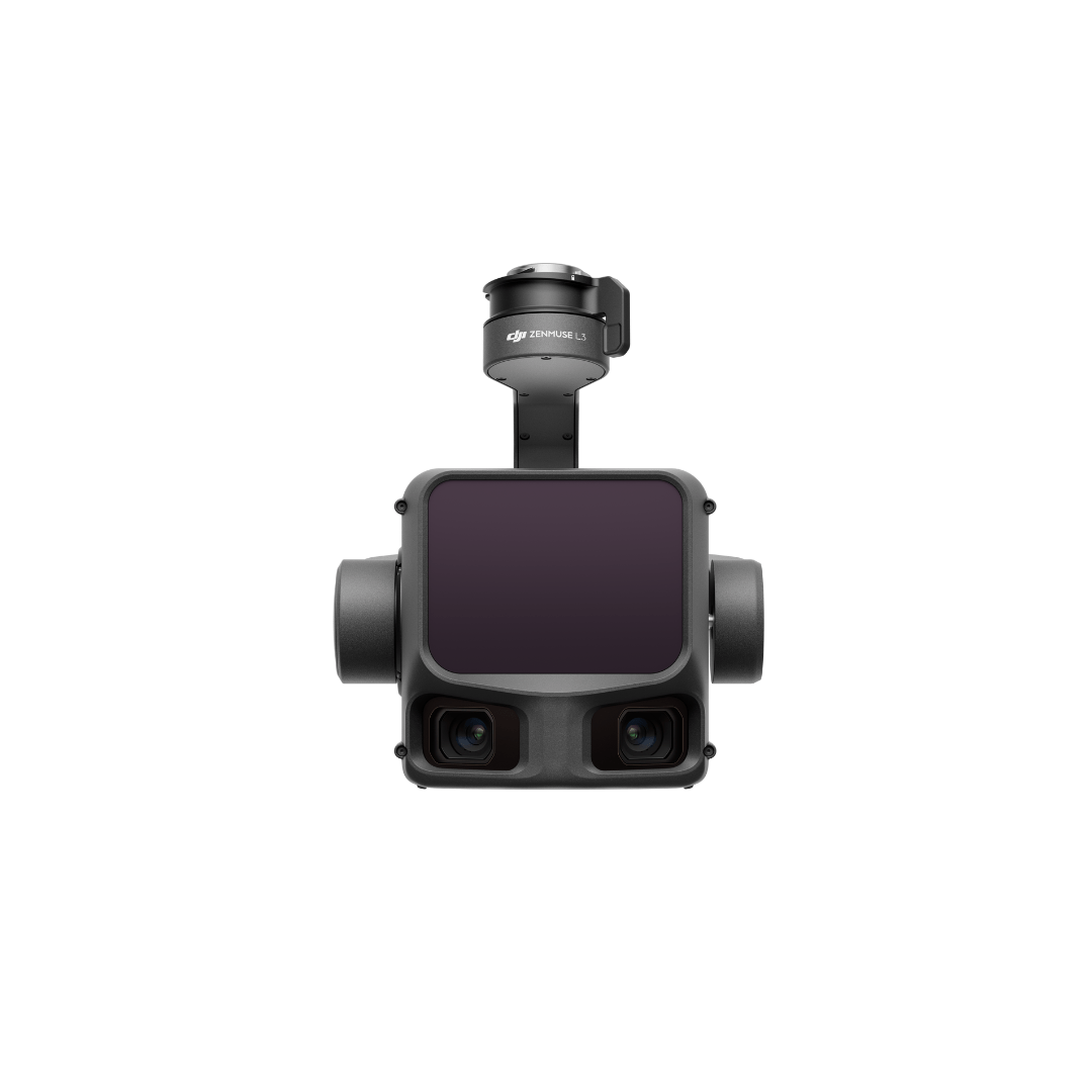
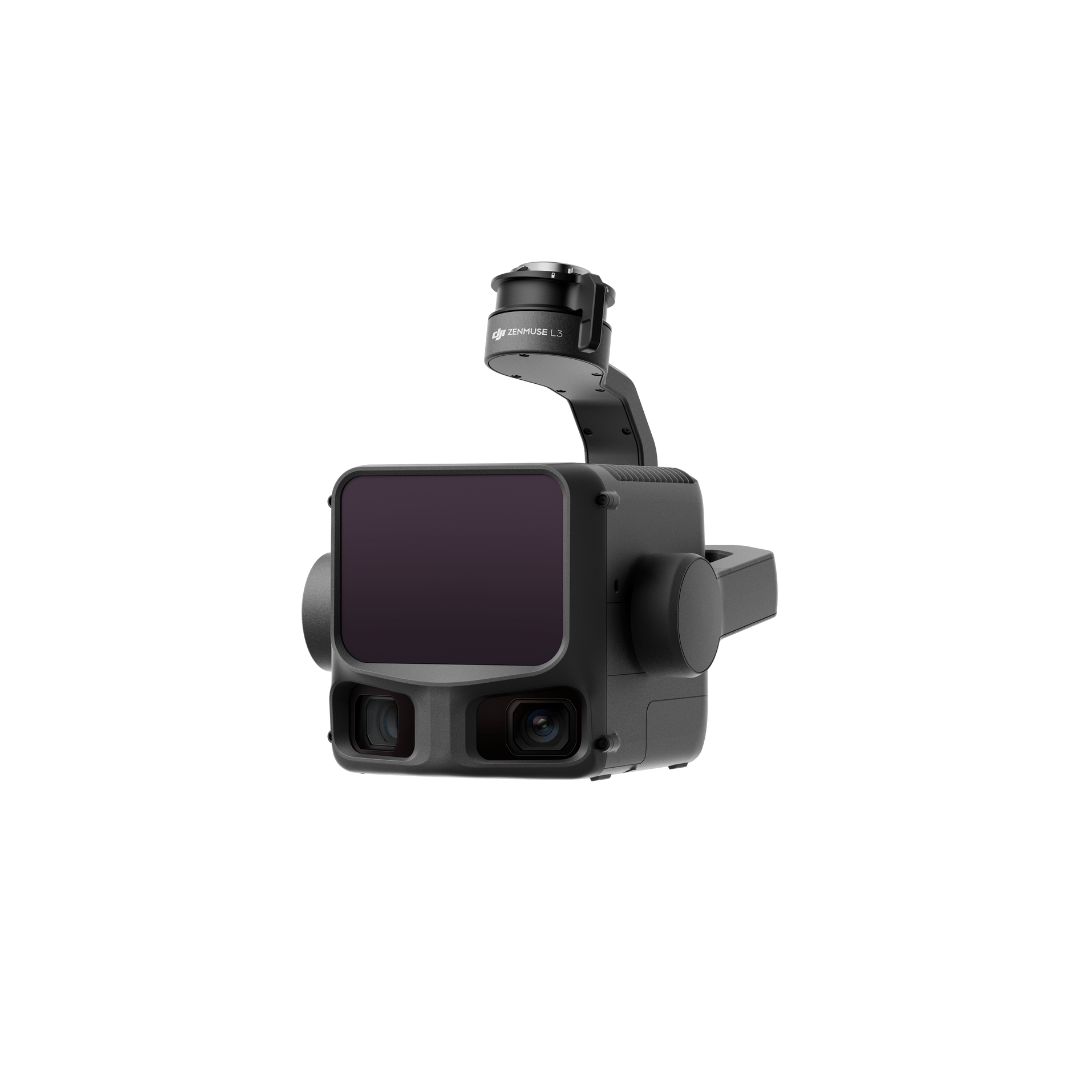
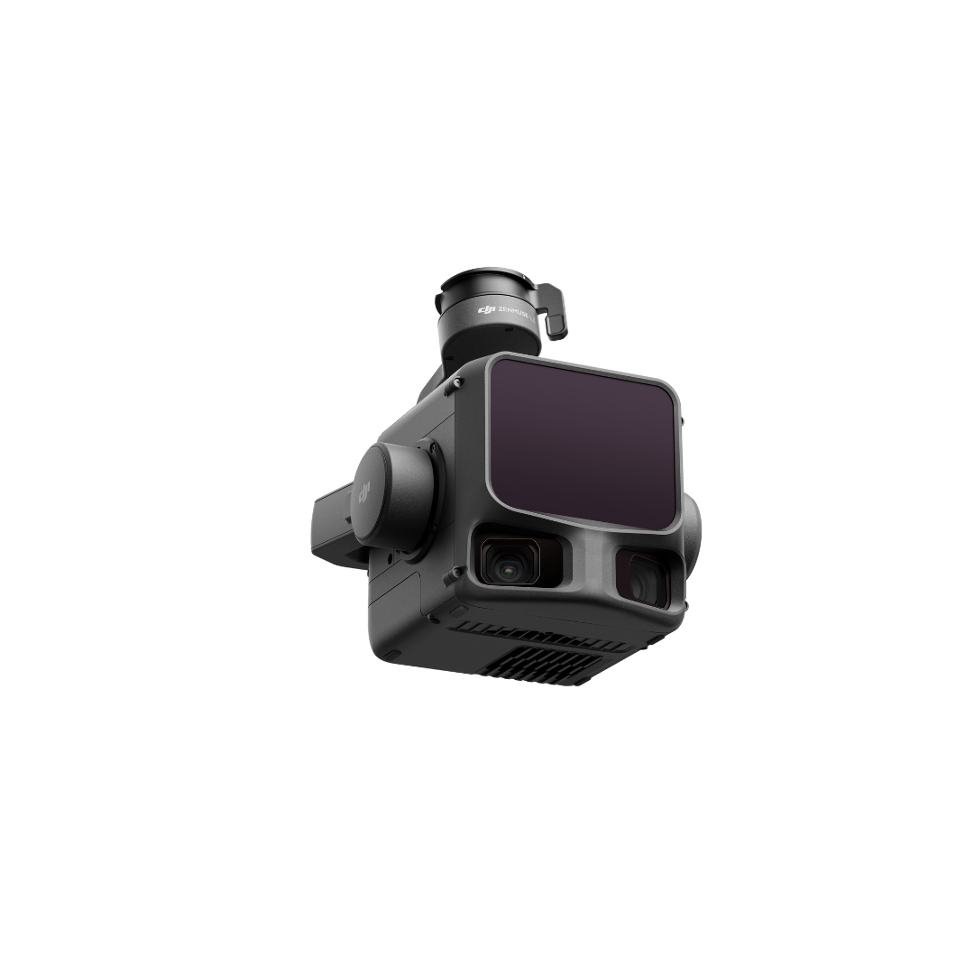
DJI Zenmuse L3
DJI is proud to introduce the new high-integration aerial LiDAR and camera system Zenmuse L3, designed for professional mapping, infrastructure inspection, forestry, and industrial applications.
The L3 combines an advanced LiDAR module with an improved detection range, a high-performance RGB camera (possibly 4/3-inch or full-frame sensor), a built-in high-precision IMU, and a 3-axis stabilized gimbal.
- Supports up to 5 (or more) laser returns and generates an even denser point cloud for penetration through vegetation and complex surfaces.
- Significantly extended detection range (e.g., 300–500 m for low-reflectivity targets) and improved vertical and horizontal accuracy (approximately 2–3 cm vertical, 3–4 cm horizontal), suitable for 1:1000-scale topographic mapping or better.
- Enhanced compatibility with Matrice RTK platforms and optimized workflow with DJI Terra software for seamless LiDAR data processing and photogrammetry.
- Increased reliability: improved IMU calibration, wider operating temperature range, and reduced module weight for easier integration and deployment.
- Ideal for large-scale mapping and survey missions — capable of covering extensive areas in one or two flights.
- Expected availability: within the coming months through official DJI Enterprise dealers.
Key Features
- 1535nm long-range LiDAR sensor for high penetration and accuracy
- Dual 100MP RGB mapping camera system
- Up to 100 km² daily coverage under optimal conditions
- High accuracy for professional mapping and surveying
- End-to-end solution for enterprise workflows
- Suitable for topographic mapping, vegetation analysis, and infrastructure inspection
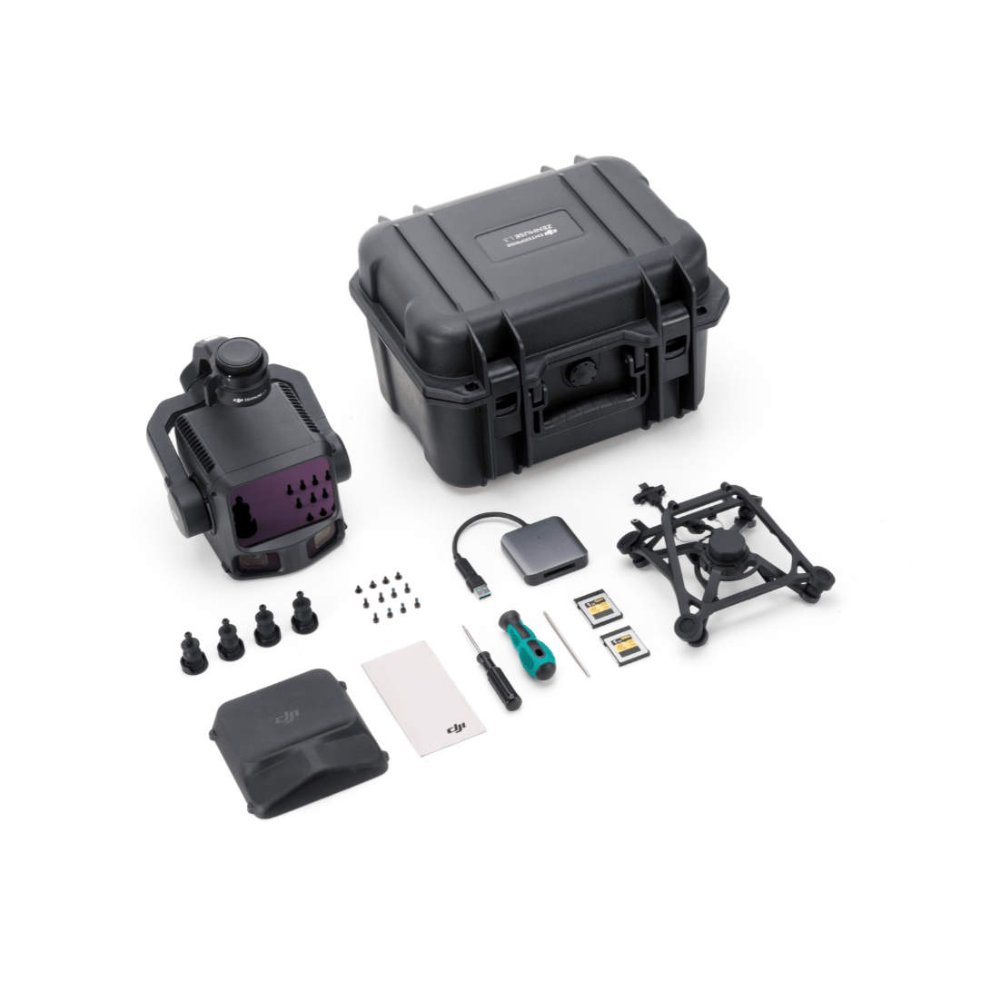
In The Box
DJI Zenmuse L3
- 1x Dji Zenmuse L3
- 1x Dji Zenmuse L3 Single Gimbal Connector
- 1x Dji Storage Case
- 4x Gimbal Dampers
- 2x CFexpress Type B Memory Card
- 1x CFexpress Type B Card Reader
- 1x DJI Matrice 400 Carrying Case Insert (Zenmuse L3)
- 1x Lens Cleaning Cloth
- Screws and Tools
Specifications
System Specifications
|
Product Name |
Zenmuse L3 |
|
Point Cloud System Accuracy
|
At 120m Flight Altitude:
|
|
Point Cloud Thickness
|
1.2 cm@1σ (120m nadir flight altitude)
|
|
Combined Horizontal FOV (Dual RGB Mapping Cameras)
|
107°
|
|
RGB Ground Sampling Distance (GSD)
|
Average Value: 3 cm (300m nadir flight altitude)
|
|
Weight
|
1.60 kg (without single gimbal connector)
|
|
Dimensions
|
192×162×202 mm (L×W×H)
|
|
Power
|
64 W (typical)
|
|
Supported Aircraft
|
DJI Matrice 400 (requires the Zenmuse L3 single gimbal connector)
|
|
Ingress Protection Rating
|
IP54
|
|
Operating Temperature
|
-20° to 50° C (-4° to 122° F)
|
|
Storage Temperature
|
-40° to 70° C (-40° to 158° F) |
LiDAR
|
Laser Wavelength
|
1535 nm
|
|
Laser Beam Divergence
|
0.25 mrad (1/e²)
|
|
Laser Spot Size
|
Φ 41 mm@120 m (1/e²)
|
|
Detection Range
|
700 m@10% reflectivity, 350 kHz
|
|
Wire Detection Range
|
21.6mm Steel Core Aluminum Stranded Wire:
|
|
Ranging Accuracy
|
Absolute Accuracy: ±10 mm
|
|
Minimum Effective Detection Distance
|
10 m
|
|
Laser Pulse Emission Frequency
|
100 kHz, recommended flight altitude < 500 m
|
|
Number of Returns
|
4, 8, 16 returns (100 kHz, 350 kHz)
|
|
Cross-Cycle Calculation
|
7 times
|
|
Scanning Mode and FOV
|
Linear Scanning Mode: Horizontal 80°, vertical 3°
|
|
Laser Safety Classification
|
Class 1 (IEC 60825-1:2014)
|
RGB Mapping Camera
|
Sensor
|
4/3 CMOS
|
|
Lens
|
Equivalent Focal Length: 28 mm
|
|
Shutter
|
Mechanical Shutter: 2-1/1500 s (f/2.0), 2-1/2000 s (f/2.8-f/11)
|
|
Photo Size
|
100 MP: 12288×8192
|
|
Minimum Photo Interval
|
JPEG:
|
|
Video Specification
|
Video Format: MP4 (MPEG-4 HEVC/H.265)
|
Position and Orientation System (POS)
|
GNSS Update Rate
|
5 Hz
|
|
POS Update Rate
|
200 Hz
|
|
Attitude Error
|
Yaw Angle: 0.02° (post-processed, 1σ)
|
|
Positioning Accuracy
|
Horizontal Accuracy: 1.0 cm + 1 ppm (RTK fix)
|
|
Supported PPK Differential Data Formats
|
DAT: Generated in Base Station Mode by D-RTK 3 Multifunctional Station and D-RTK 2
|
Gimbal
|
Degrees of Freedom
|
3-axis (pitch, roll, yaw)
|
|
Angular Accuracy
|
±0.01°
|
|
Mechanical Range
|
Pitch: -135° to +73°
|
|
Controllable Range
|
Pitch: -120° to +60°
|
|
Self-Check Method
|
Roll Axis: Self-check not required
|
|
Mounting Method
|
Detachable DJI SKYPORT (Zenmuse L3 single gimbal connector)
|
Data Storage
|
Raw Data Storage
|
Photo/IMU/Point cloud/GNSS/Calibration files
|
|
Standard Memory Card
|
CFexpress™ Type B Memory Card, sequential write speed 1500 MB/s
|
|
Standard Card Reader
|
Read/write speed > 900 MB/s
|
Software Ecosystem
|
Data Collection
|
DJI Pilot 2
|
|
Data Processing
|
DJI Terra
|
|
Data Application
|
DJI Modify
|
|
Cloud Application
|
DJI FlightHub 2
|
|
Data Format
|
DJI Terra supports exporting point cloud models in the following formats:
|